When it opens to the public in October 2024, the Stockholm Archipelago Trail will link 21 islands, offering visitors to Stockholm easy access to Sweden’s stunning natural beauty.
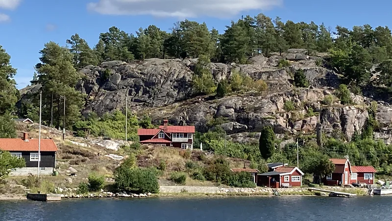
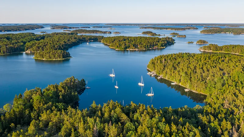
On my first boat trip into the Stockholm Archipelago, the color palette was vivid. The mirror-like shimmer of the labyrinthine sund (straits) divided the green of densely forested islands, whose boulder-strewn shores were weathered to the hue of white gold. Fairy tale-like rust-red cabins peeked out from the trees or perched atop rocks. As the boat passed one stretch of coast, another quickly came into view, stretching toward one horizon and then the next. This idyllic group of some 30,000 isles and islets comprises one of the world’s largest archipelagos, with five times the number of islands as Greece.
I was there to hike the newly created Stockholm Archipelago Trail (SAT), which will officially open to the public in October 2024. Connecting the archipelago from Arholma Island in the north to Oja in the far south via marked paths for the first time—and making it one of the world’s only archipelagos linked end-to-end by a trail—the SAT will open up these islands to the public like never before.
Although the archipelago has long been popular for leisure activities like boating and beachgoing, the creation of the 270-kilometer SAT signals that these islands are perfect for deeper exploration on foot. The trail runs across 21 islands that showcase the archipelago’s abundant natural beauty and highlights the need to protect its fragile ecosystems.
“We want to encourage everyone to walk here to raise the profile of the islands,” said SAT creator Michael Lemmel. “Many people already visit, but often in specific ways. For example, it’s popular to come by private boat, but those who do typically travel no more than 50 meters inland from the dock. The SAT will spread visitors out over a wider area than just a marina.”

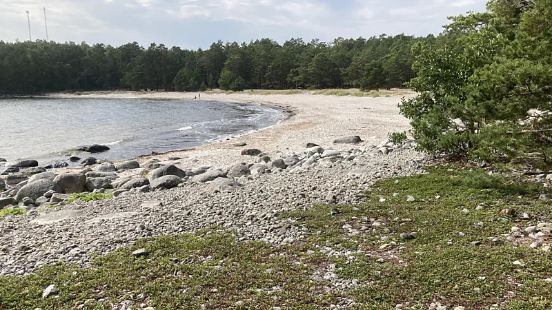
Lemmel and other SAT supporters believe the archipelago—a 1,700-square-kilometer span of tree-covered islands and rocky islets edged by sandy beaches and skerry-filled bays—has enormous potential to redistribute the influx of tourists in the Stockholm region more evenly. “The archipelago tourism window is very specific: an eight-week boom from late June to August and almost nothing the rest of the year,” Lemmel said. But the walking season extends from May to September or October, which means the SAT will ease pressure on hotspots and peak visiting times.
Despite the archipelago being a regional highlight, a 2022 Visit Stockholm survey found that while 81% of overseas visitors to Stockholm tour the city, only 26% take a boat to explore its islands. Yet there is so much to see and do: basking on the beaches of Sandhamn and Nåttarö; kayaking across island-speckled bays; relaxing in remote cabins with views of the sea, sky, forests, and birdlife framed through the windows; and, above all, soaking in the tranquillity that is harder to find elsewhere.
Cars are not allowed on the islands along the SAT, boats can only dock at certain points, and the trail is not suitable for bicycles, making walking the best way to explore. Adventurers can hike the entire island-to-island route, while more casual outdoor enthusiasts can pick and choose their favorite sections. The trails are well-marked with signs and strategically placed benches for resting and taking in the views. The SAT also minimizes its environmental impact by using removable bands for waymarking (blue for the sea, yellow for sand) so as not to damage trees permanently. It follows pre-existing human and animal paths, eliminating the need to cut new trails.
“Making the trail also helps people invested in protecting the islands to subsist on the archipelago year-round,” said Marie Östblom from the Stockholm Business Region, which is overseeing the trail’s development. “Walkers will generate extra demand for local businesses, such as lodgings and tours. Most islands have few residents, so making important decisions, including those related to conservation, becomes more efficient.”

Over six days, I hiked the SAT across six islands—Finnhamn, Grinda, Sandhamn, Utö, Ålö, and Nåttarö—covering more than a quarter of the entire trail. With so many islands and thick forest cover, locals say the only way to identify a location from the water is by the shape of its trees. On land, however, each island has its own distinctive characteristics.
Finnhamn is the only island in the archipelago with oak trees, and massive rocky outcrops burst out of its forest floor, creating a thrilling hiking experience. Grinda offers a gentler mix of forest and farmland. Both islands are designated nature reserves. Sandhamn is the most visited island, but the sandy pine forests on its southern and western sides are serene and beautiful. Neighboring Utö and the Ålö-Rånö Nature Reserve feature deep skerry-filled inlets and higher elevations that offer some of the archipelago’s most breathtaking panoramas. Meanwhile, Nåttarö’s pine and birch-fringed white sand beaches are unparalleled, and the island is one of Sweden’s first marine nature reserves.
“We want people to come here to see these treasures for themselves,” Lemmel said. “It’s harder to care about conserving the islands without appreciating what they offer, and right now, even Stockholmers don’t know much about them. We’ve got thousands of islands—some of which are on the SAT—that are wildernesses, just a short boat ride from a capital city. How many places can say that?”
Despite the natural beauty and rich birdlife, including Sweden’s largest sea eagle population, the archipelago is vulnerable to pollution. Its intricate network of waterways means that contaminated water from the Baltic Sea and over-fertilization in Sweden’s rivers can become trapped here. But this has led the archipelago to serve as a testing ground for developing long-term solutions to environmental threats.
On Utö, the SAT skirts a man-made wetland that hosts a pioneering project to rejuvenate marine life across the Baltic, according to its creator, Thomas Hjelm. By reintroducing predator fish like pike and perch, which had been fished almost to extinction, Hjelm has created a self-sustaining ecosystem that purifies water within an eight-kilometer radius. The fast-growing wetland reeds, when cut, can be used to create eco-friendly fertilizer, offering an alternative to traditional turf-cutting methods that release CO2.

“This wetland is a blueprint for how it can be done,” said Hjelm. “But several hundred of these wetlands around the Baltic would make a massive difference.”
The Sandhamn section of the trail is the busiest due to the island’s popular port and beach. One of Sandhamn’s hotel owners, Lena Josefsson of the Sandhamn Seglarhotel, said that creating a sustainable travel experience on the archipelago is challenging, given that essential services like recycling facilities and supermarkets are often only available on the mainland, a boat ride away.
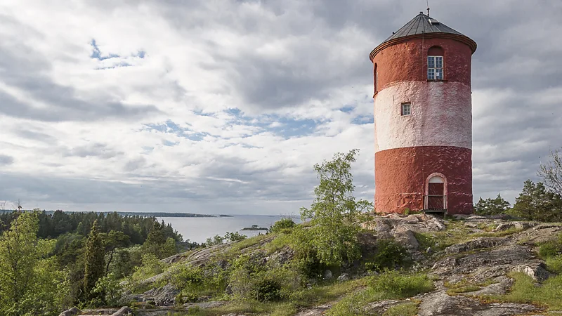
“We’ve come up with a few solutions,” she said. “We’ve started collecting all our food waste from the restaurant and turning it into fertilizer. We’re also opening an off-grid retreat at a lighthouse offshore from Sandhamn, which we hope will attract guests with a lower carbon footprint.”
As I hiked the SAT, I understood Lemmel’s point about seeing the archipelago to appreciate its ecological significance. Words like “Amazon” and “Arctic” instantly evoke environmental concerns, but the Stockholm Archipelago does not yet carry the same weight. The trail changes that. It allows visitors to experience the beauty of these islands firsthand, like trees giving way to an unexpected beach or a silent inlet full of eider ducks. More importantly, it encourages people to think about why these things matter.
“And now is the best time to visit,” said Östblom with a smile. “Late August to October is our magic season. The summer crowds are gone, but the water is still several degrees warmer than on the Swedish mainland.”
After six days of rugged hiking on the SAT, the water looked incredibly inviting: calm as a millpond and bathed in golden autumn light. So, I jumped in.