We wish we could deliver a more favorable forecast for your weekend, but the good news is that a complete washout isn’t expected.
As we head into Saturday, be prepared with your rain gear. The low-pressure system that’s been lingering offshore will continue to bring scattered showers to Greater Boston.
The Cape and the Islands will see the highest chances of rain, with some heavy downpours likely. Central Mass might experience a few showers, but otherwise, expect mostly cloudy skies and areas of patchy fog. Highs will be in the low 60s.

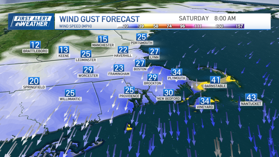
Winds will be gusty, coming from the east-northeast at speeds up to 30 mph in Boston and reaching 40 mph on the Cape and Islands.
This onshore flow and gusty winds raise concerns along the coast. A Coastal Flood Advisory is in effect until Sunday for the North and South Shore beaches, as well as the Cape and Islands, particularly around high tide.
For Boston, high tide occurs at around 2 a.m. and 2 p.m. Saturday, and again on Sunday at 3 a.m. and 3 p.m. Be cautious, as minor flooding is possible, especially in flood-prone areas. Remember: turn around, don’t drown. High surf is also expected, with waves around 10-14 feet in the surf zone through Saturday.
By Sunday, the low-pressure system will begin to move away, allowing for some peeks of sunshine between the clouds. Highs will be in the mid-60s. Sunday also marks the official start of fall at 8:44 a.m.
A little sunshine is anticipated for Monday and Tuesday before more unsettled weather returns by Wednesday and could persist through the weekend. We’ll have several days to fine-tune the forecast.